www.antik.it/Antique-globes-world-maps/8360-Terrestrial-Globe/
Code 8360
EUR 900.00
In stock
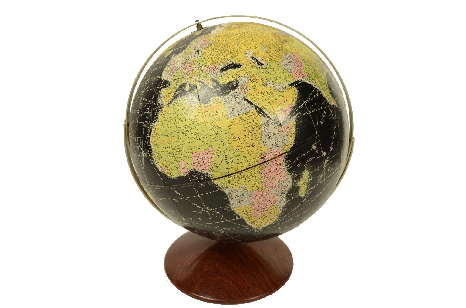
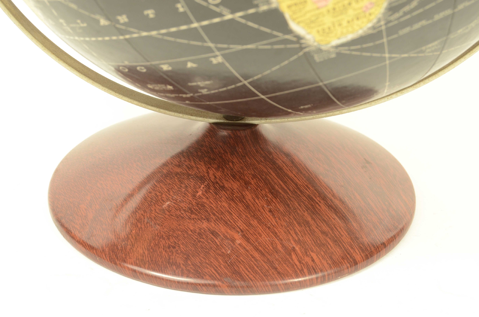
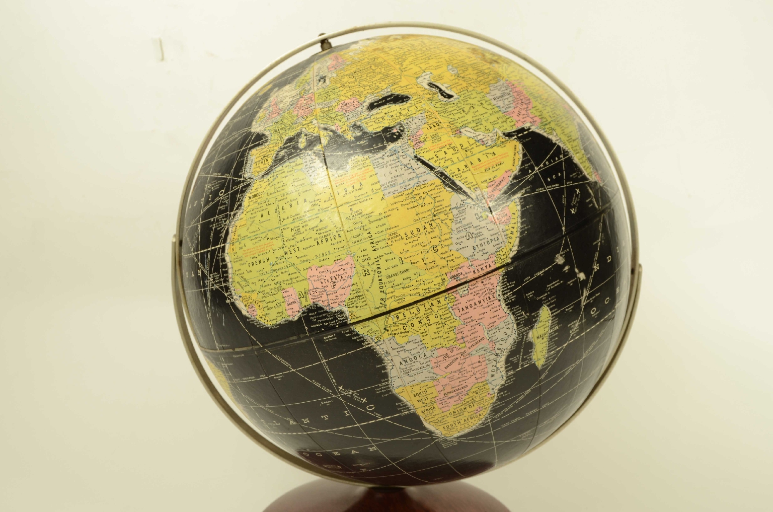
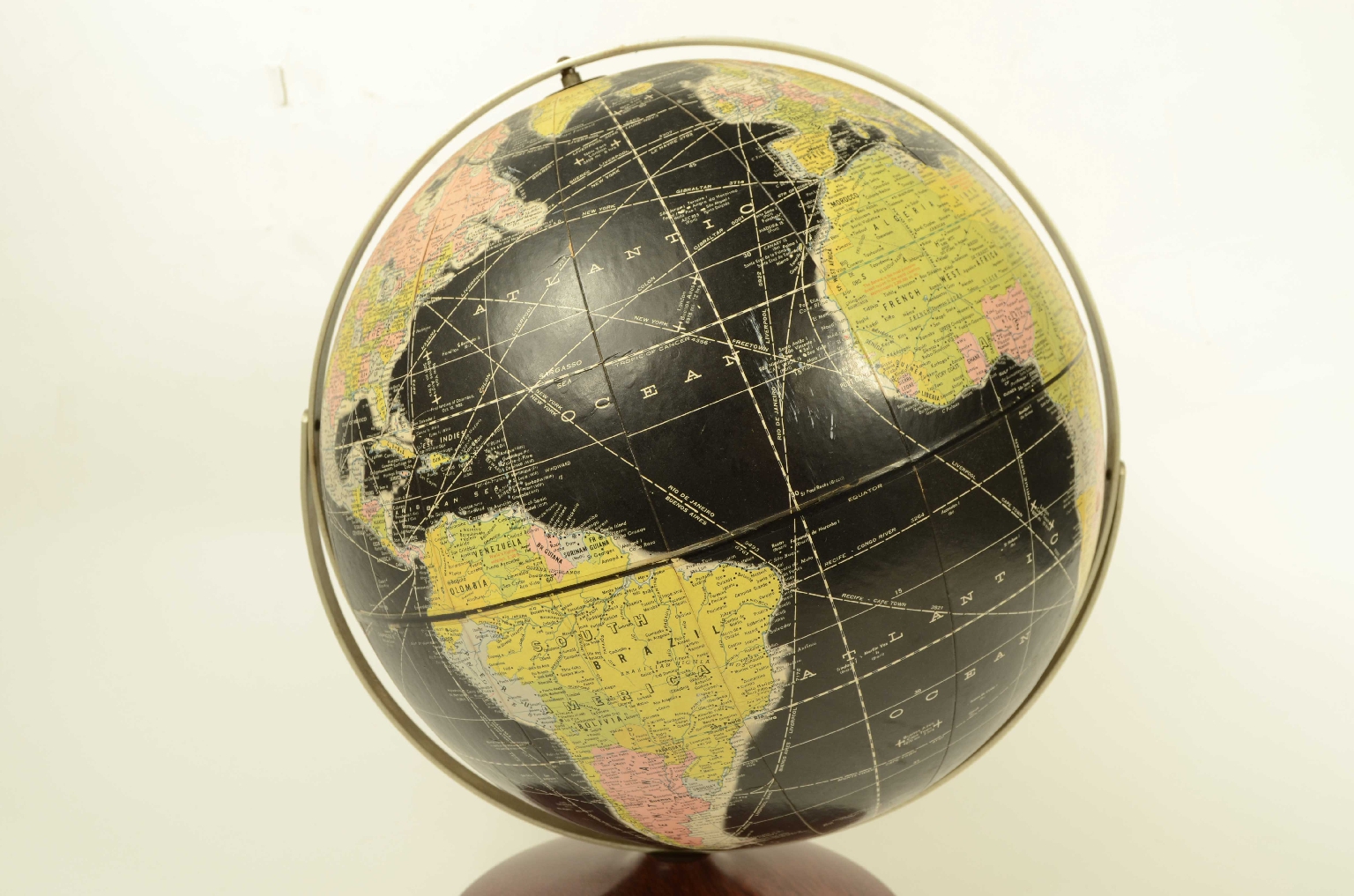
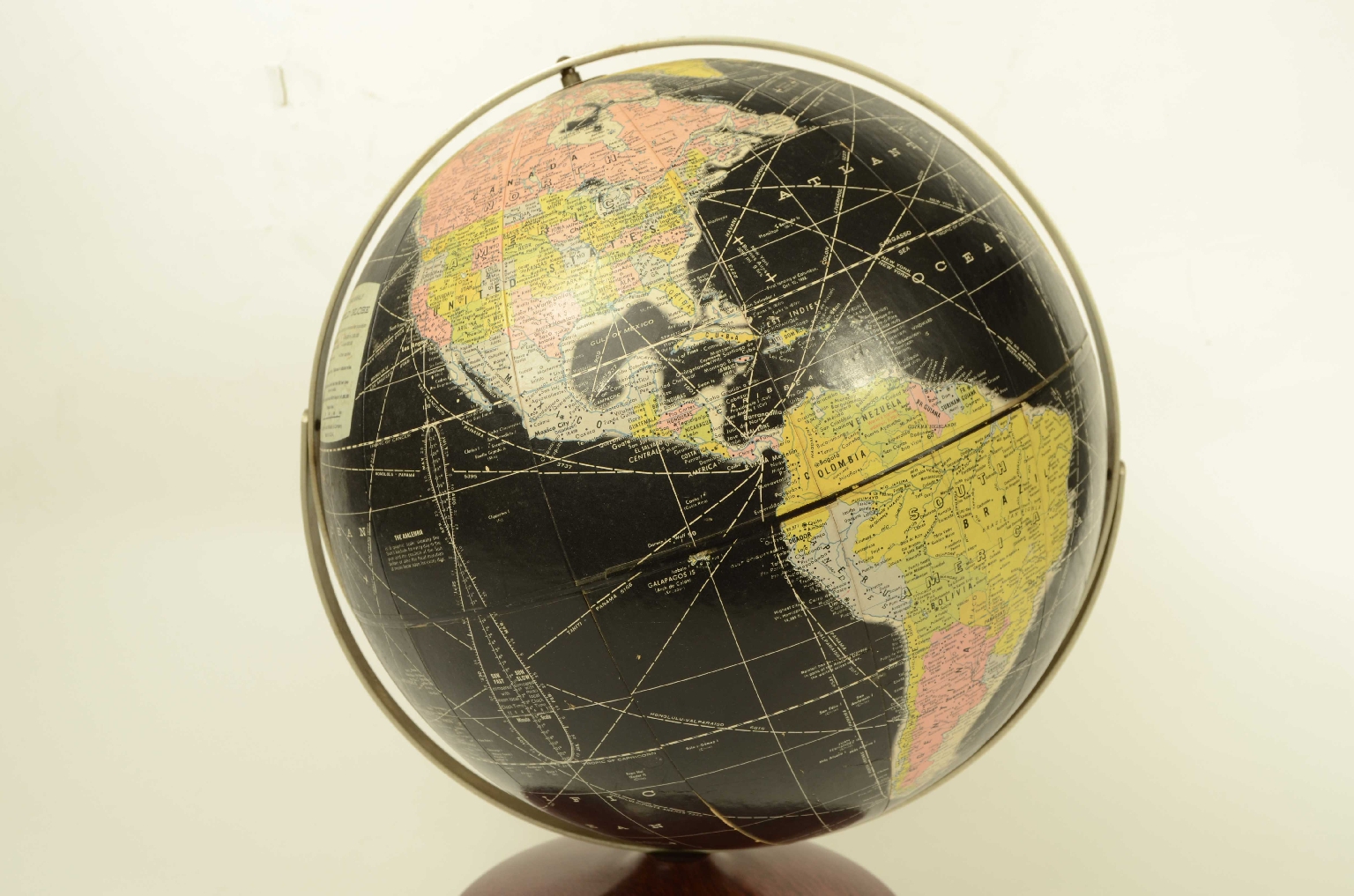
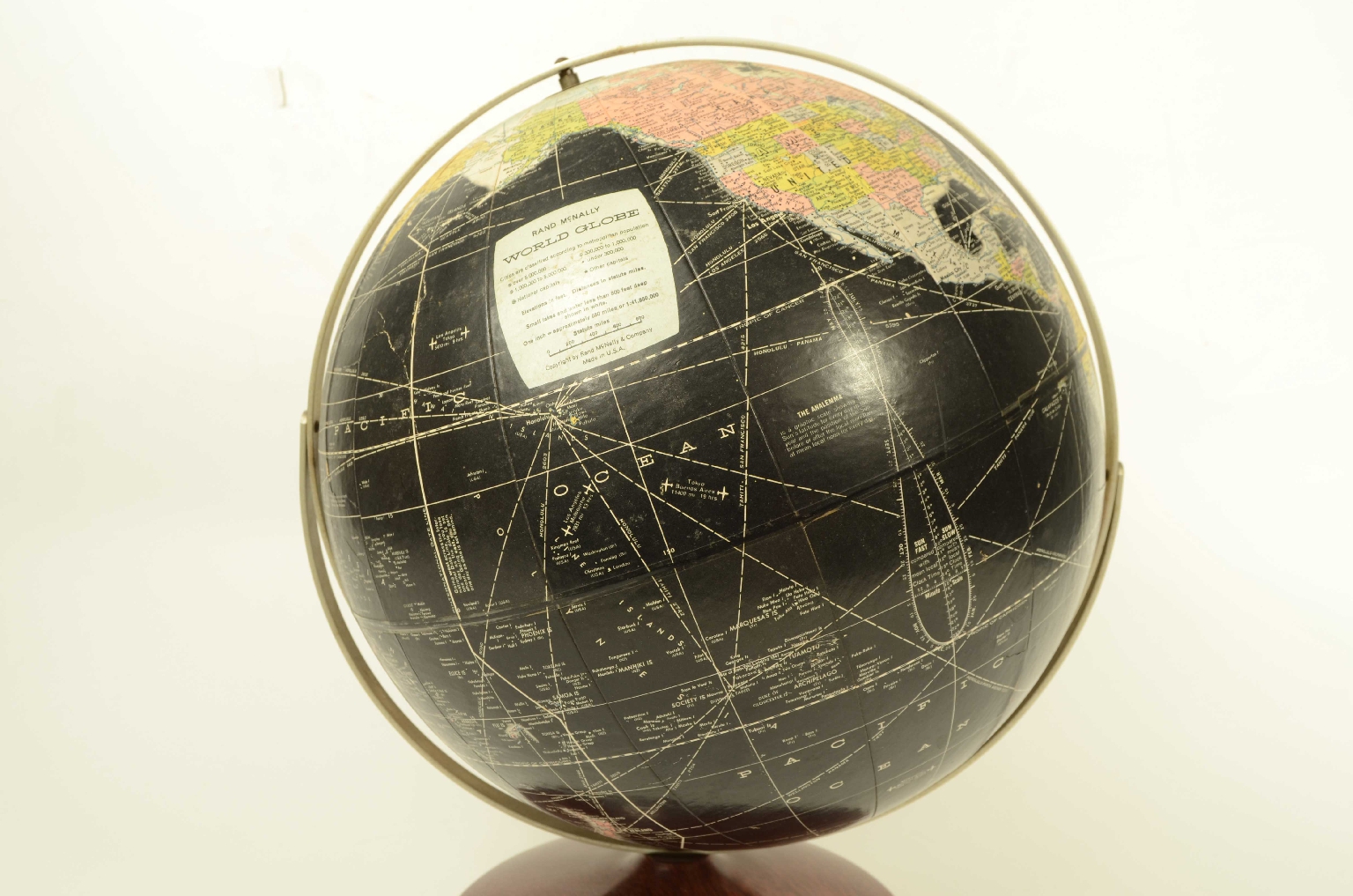
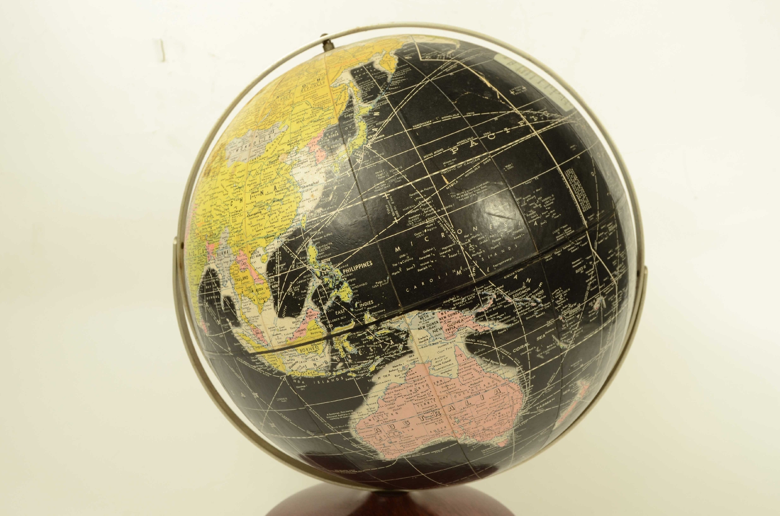
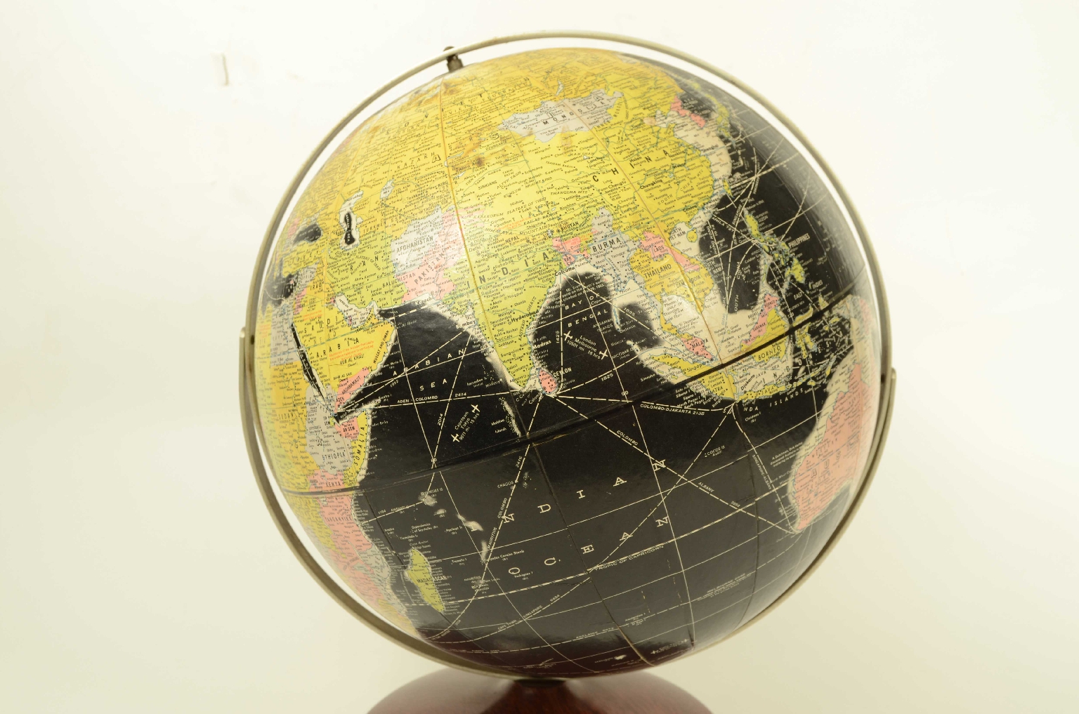
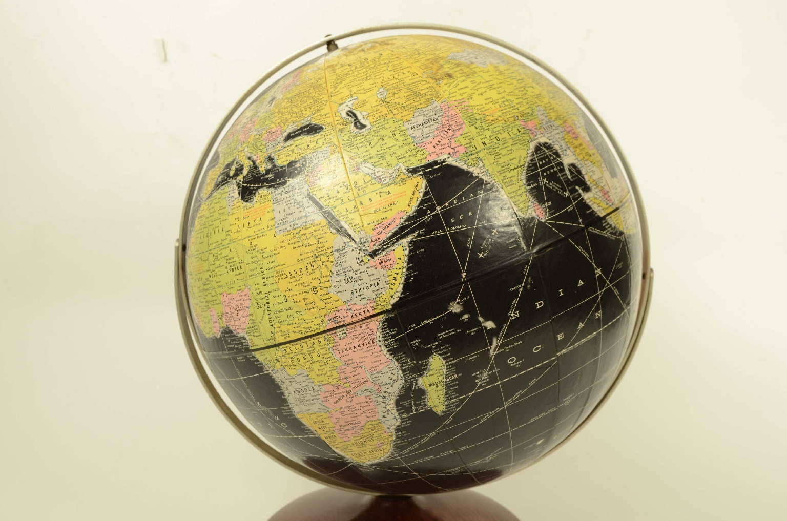
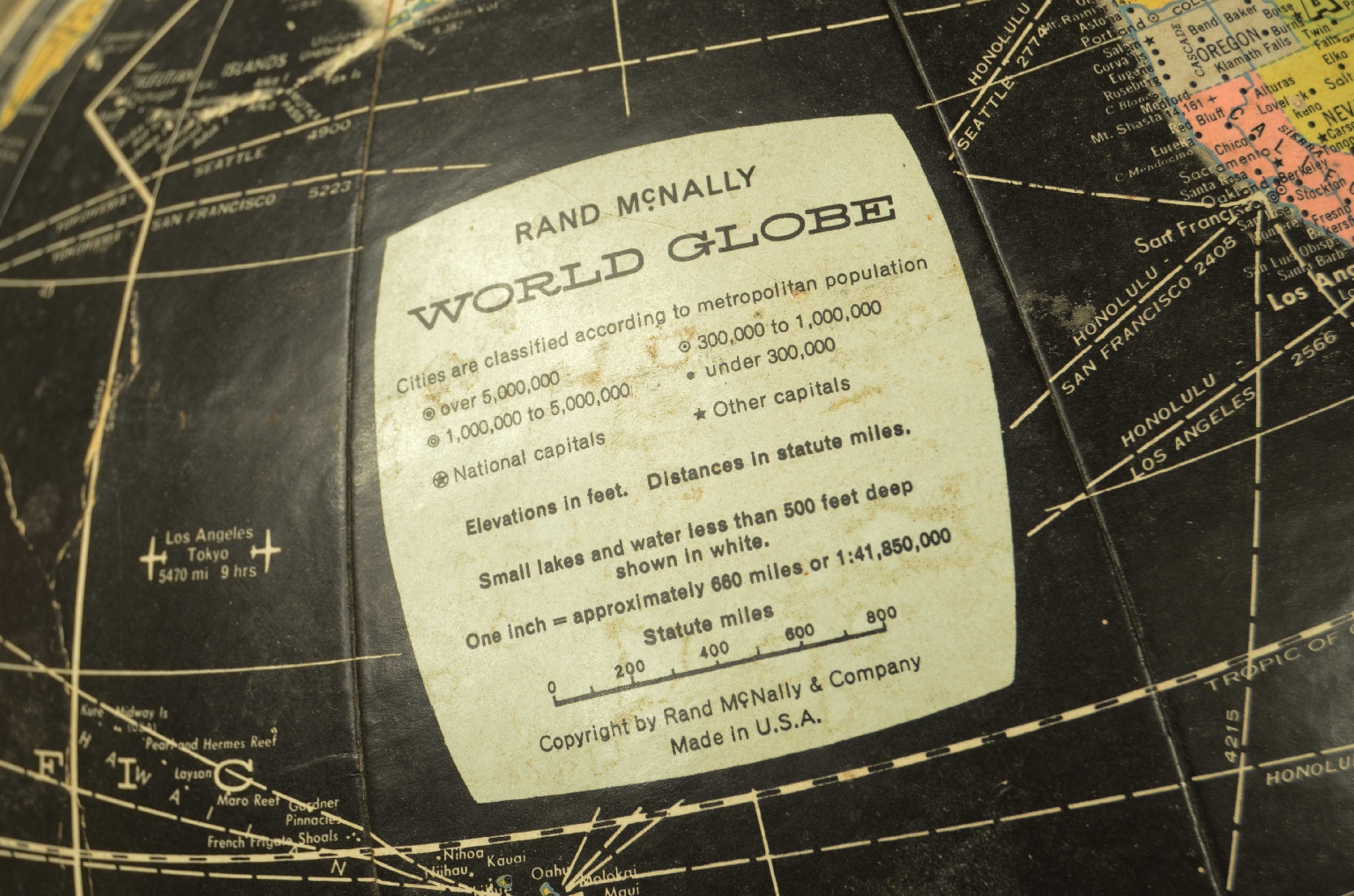
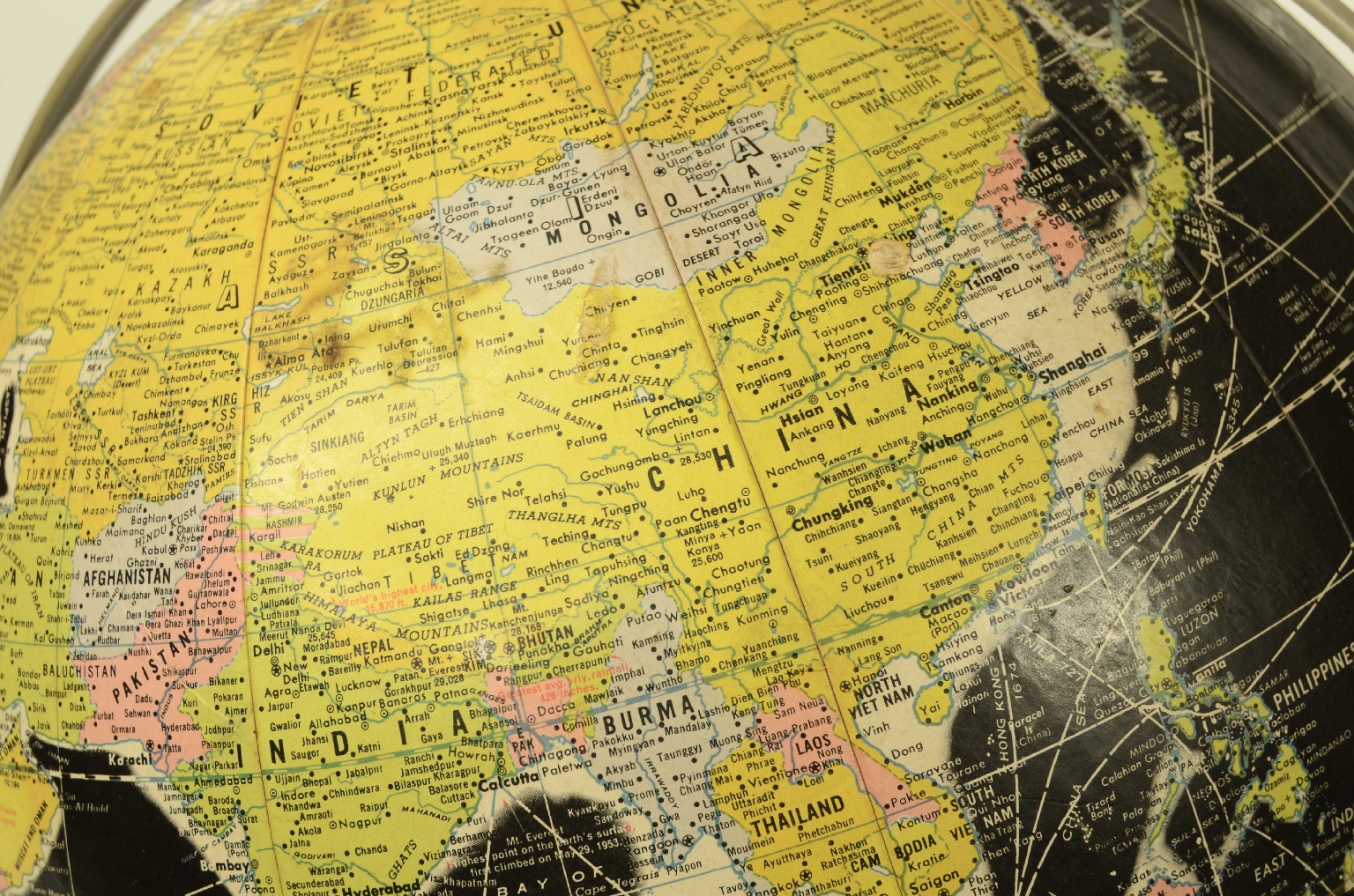
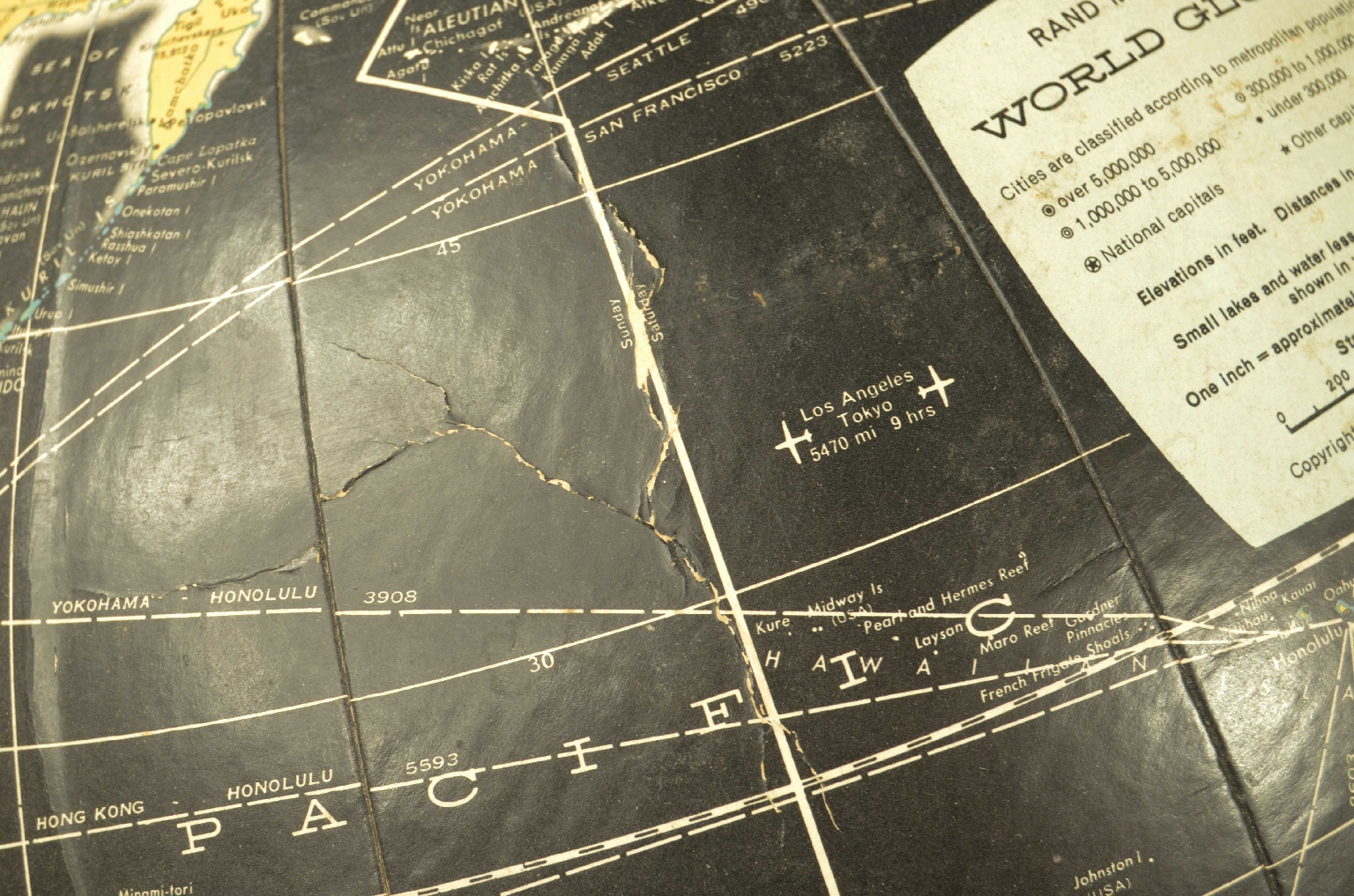
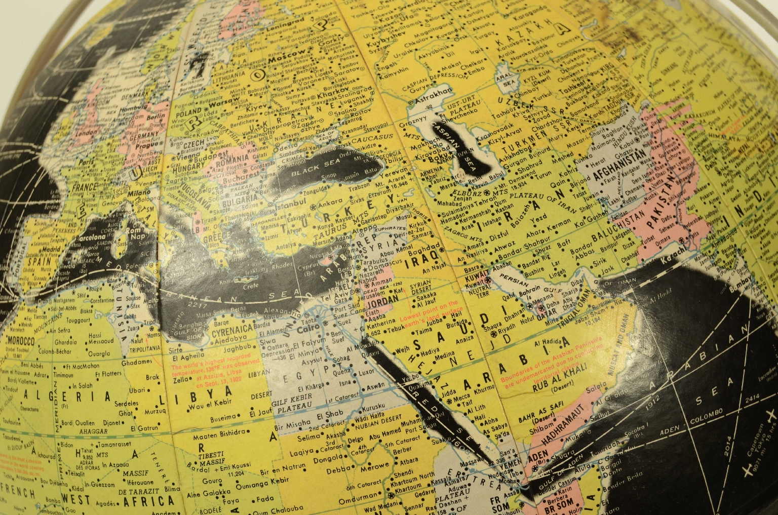
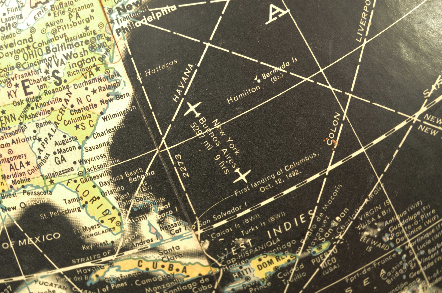
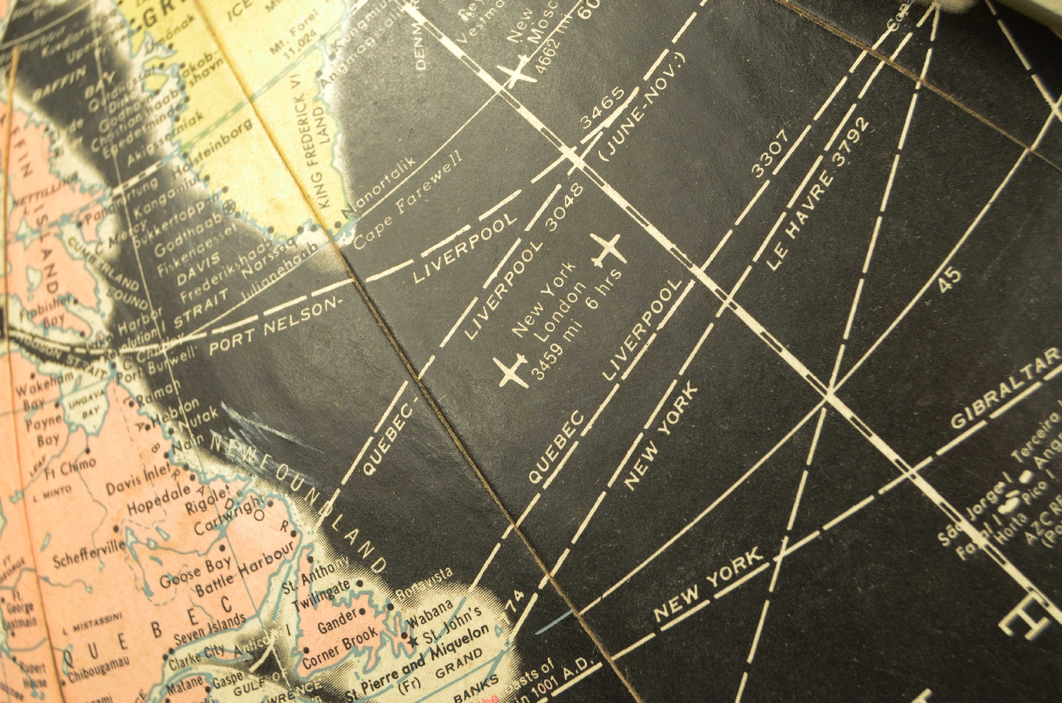
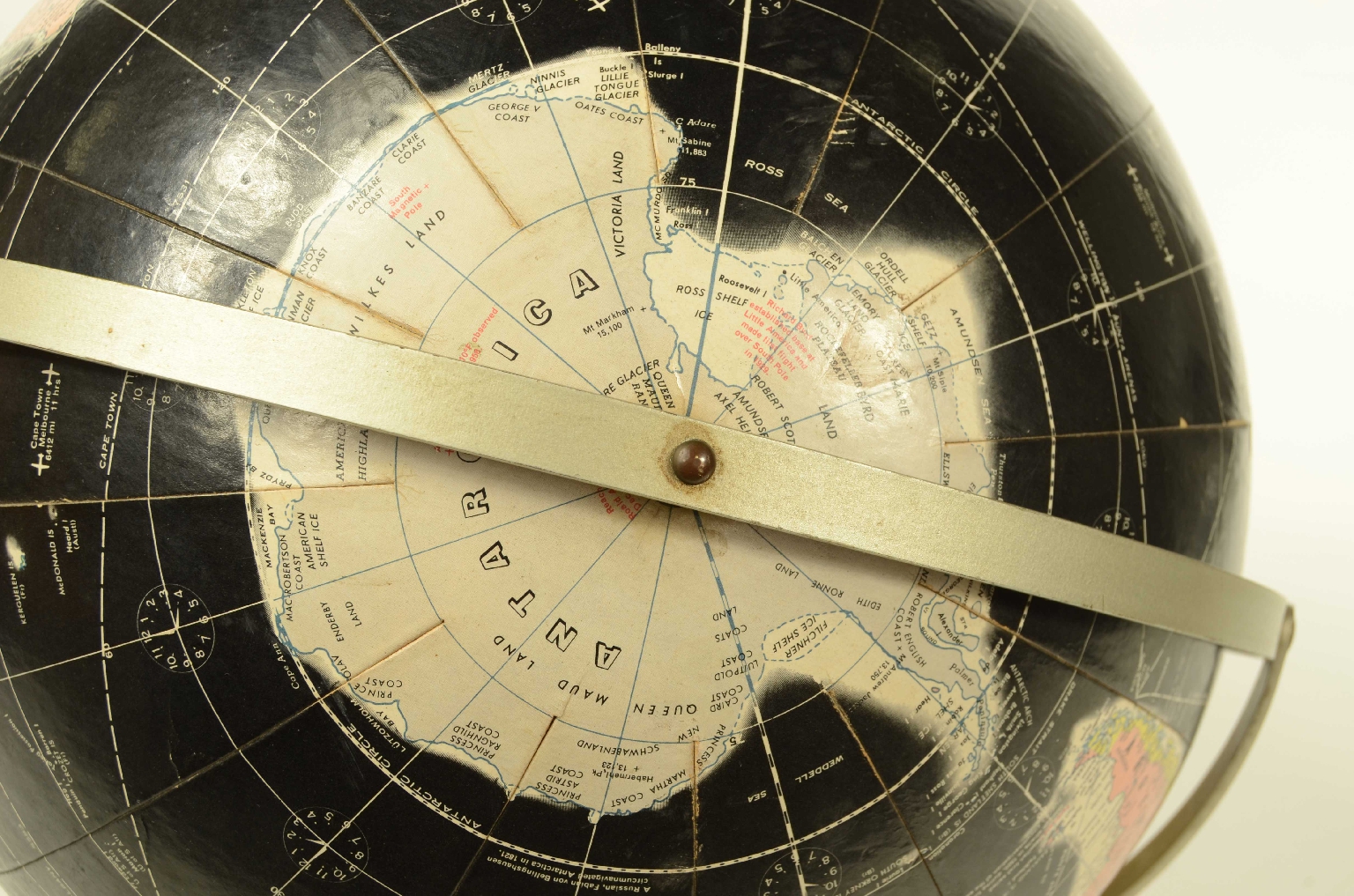
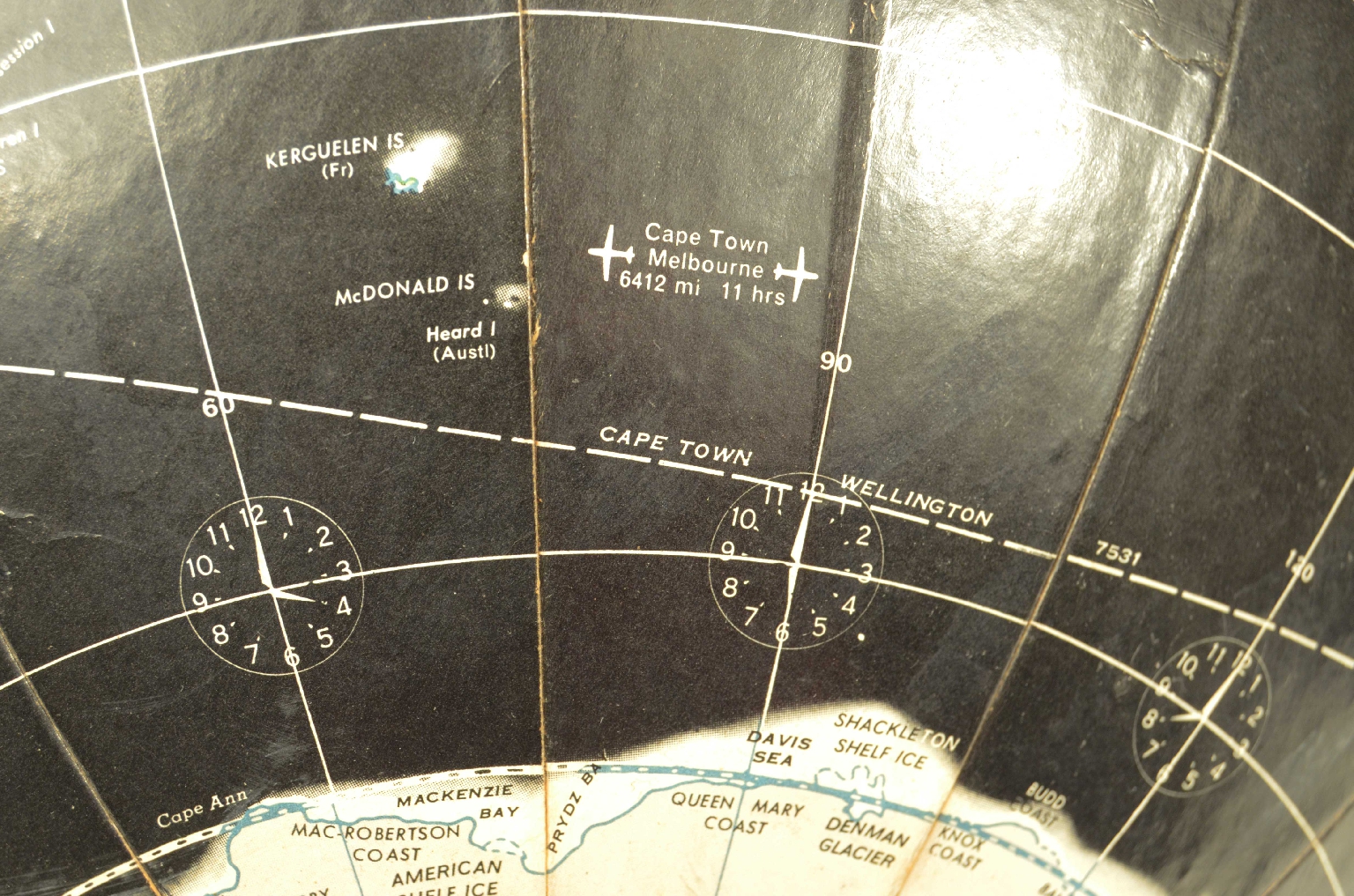
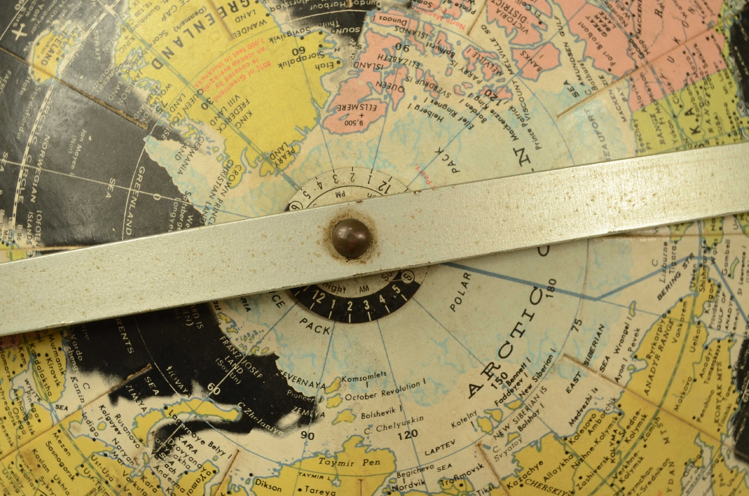
1765041224Code 8360 Terrestrial GlobeTabletop globe produced by Rand McNally around the 1950s. It features a lithographically printed political map in pastel colors typical of the period, featuring oceans and black seas, mounted on a meridian with a metal base.
Good signs of use, excellent readability.
Dimensions: 30 x 40 cm – 12 x 15.8 in.
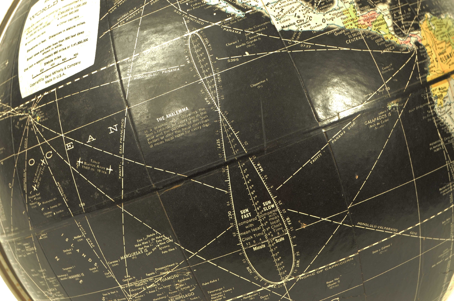
In addition to the very well-defined territorial map, complete with some maritime and air trade routes, it features the twelve time zones and the analemma, the figure-eight curve printed on the ocean that shows the declination of the Sun throughout the year. The analemma makes the globe not only geographical but also educational and astronomical, and was a distinctive feature of Rand McNally school globes of the period.
Rand McNally & Company is a historic American cartographic company founded in 1856 in Chicago by William H. Rand and subsequently directed by Andrew McNally.
In 1872, it introduced the revolutionary wax printing technology that allowed for sharper and more easily updated maps.
In the 1920s, it published one of the first automobile road atlases, anticipating the era of road tourism in the United States.
The first globes, built in the early 16th century under the pressure of great geographical explorations, immediately began to be used for educational purposes in princely courts, monasteries, and colleges. The globe later began to conquer universities and high schools. In the 18th century, Didier Robert de Vaugondy, the official geographer of King Louis XV of France, thanks to his experience in globe construction, expanded the article “Globe” of the Encyclopédie by illustrating in detail the distinction between a celestial globe (which represents the concave surface of the sky with its constellations) and a terrestrial globe (which instead represents the surface of the Earth with its seas, islands, rivers, cities, etc.) and the techniques for making them: two papier-mâché hemispheres pressed and modeled on or inside a hemispherical mold, dried and strengthened on the inside with a wooden board, then glued and covered with a thin layer of plaster on which the globe’s meridians of areas between two meridians, generally twelve, were glued, made of paper previously printed by engraving on a copper plate and colored, each of which covered 30 degrees of longitude.
FAQ
Do you provide an authenticity certificate/expertise?
Of course! The legislative decree n. 42/2004 stipulates that who sells works of art or historical and archaeological items has the obligation to deliver to the purchaser the documents attesting to the authenticity of the object, or at least to submit the documents relating to the probable attribution and origin. Antik Arte & Scienza provides an expertise (as warranty) that contains a description, period and assignment or the author, if known, of the item.
How can I pay?
Secure payments by PayPal, credit card or bank transfer.
What are the shipping terms and the delivery schedule?
Shipping by DHL or UPS is free (but if we are shipping to a country non-EU remember that any taxes and customs duties are on your expense), and items will be sent just after receiving of payment.
Italy: delivering on the average in 24 h.
Europe: delivering on the average in 2/3 weekdays.
Other countries: delivering on the average in 5 weekdays; custom duties charged to the buyer.
Is shipping insured?
Of course! Free insurance by Lloyd's London that covers almost all destinations.
If I change my mind, can I return the item?
Of course! (see our general terms for more information).
e-Shop
Antique globes-world maps
Code 8360 Terrestrial Globe
Antik Arte & Scienza sas di Daniela Giorgi - via S. Giovanni sul Muro 10 20121 Milan (MI) Italy - +39 0286461448 - info@antik.it - www.antik.it - Monday-Saturday: 10am-7pm